About Us & Why We are
Land Surveying at it’s Best
SERVING CENTRAL AND EASTERN MASSACHUSETTS
Our family-owned Engineering and Land Surveying firm has been serving the community for the last 35 years. Our team has grown and includes experienced professionals and dedicated support to provide both personal and professional engineering/land surveying services. We are Title 5 Inspections Specialists.
Land Surveying Services We Offer
Engineering
- Commercial Site Design
- Residential Site Design
- Septic System Design
- Soil Evaluation
- Title 5 Septic System Inspection
Land Surveying
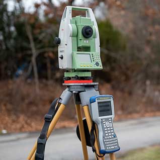
Land surveying is the art and science of establishing or reestablishing corners, lines, boundaries, and monuments of real property (land) based upon recorded documents, historical evidence, and present standards of practice.
Types of Surveys
Mortgage Location Survey
Ordered by a lender or title insurer, a Residential MLS is intended to provide proof that certain improvements are actually located on the property as described in the legal description. The survey plat must show particular information discovered from measurements taken at a site, and not necessarily evidenced by public record.
A Commercial MLS is a low-cost alternative to an ALTA Survey, although it also sacrifices some accuracy. The commercial mortgage location survey follows the same state standards as a residential mortgage location survey, so the lender must be willing to accept these standards in place of the ALTA standards.
ALTA Survey
Typically contracted by the title company, lender, or attorneys representing involved parties for commercial property purchases, refinances or improvements, an ALTA or ALTA/ACSM survey is based on standards put forth jointly by the American Land Title Association and the American Congress on Surveying and Mapping . By utilizing a universal standard, an ALTA survey provides confidence that results are guaranteed.
Boundary Survey
A “Boundary Survey” is used to identify a property’s boundary lines. In this type of survey, the surveyor will set (or recover) the property corners and produce a detailed plat or map. To accomplish this, the surveyor will research the public records and do research in the field, take measurements and perform calculations. This type of survey is necessary for construction and permit purposes.
Topographic Survey
A topographic survey includes field measurement and preparation of a plat to establish land elevations. These surveys are typically contracted by a residential or commercial property owner before making improvements to the property such as, but not limited to, additions, landscaping or parking lots.
Land Surveying
- Property Line Survey
- ALTA Title Survey
- Plot Plans
- Topographic Survey
- Construction Support
- FEMA Elevation Certificate/ LOMA
Environmental
- Wetland/Resource Area Delineation
- Notice of Intent Filing
- Flood Plain Analysis
- Compliance Monitoring
- Storm Management
Locations
167 Hartford Ave.
Bellingham, MA 02019
(508) 966 – 4130
Fax: (508) 966 – 5054
214 Worcester St.
North Grafton, MA 01536
(508) 839 – 9526
Fax: (508) 839 – 9528
1115 Main St.
Hanson, MA 02341
(781) 294 – 4144
Fax: (781) 293 – 4111
Address
Main Office
North Grafton, MA 01536
(508) 839 – 9526
Phone
(508) 839 – 9526
Fax: (508) 839 – 9528


